

Ruabhal [Rueval]
Good walks are even better shared.
Overview
Ruabhal [Rueval]
Located in the captivating Outer Hebrides, Ruabhal is not for the faint-hearted—or at least, not for those who don't enjoy a bit of rocky charm. Standing tall at 452 meters, this Marilyn is famous not just for its height but also for the stunning vistas it offers upon summiting.
Geology
The mountain is primarily composed of Lewisian gneiss, giving it a rugged appearance and a geological pedigree that dates back over 3 billion years. A walk here feels a bit like strolling through a living museum of Earth's early history, minus the dinosaurs (thankfully).
Routes
Stornoway to Ruabhal Trail
Begin your adventure in the bustling town of Stornoway, where you can sip a cup of tea and tighten your boots. This 7.0 km route is marked as Moderate, allowing hikers to enjoy the rich landscapes gradually gaining altitude. Along the way, take a moment to appreciate the flora—just watch out for the bogs!
Summit Features
At the summit, you’ll find a prominent cairn, perfect for selfies and a well-deserved snack break. After all, you need to refuel after that ascent!
Terrain Types
The terrain consists of rocky paths interspersed with grass and heather. The ground can be tricky at times, so sturdy footwear is highly recommended. Trust me, your feet will thank you later.
Views
Once at the top, the panorama stretches far and wide—look out for the sea lochs, the majestic Harris mountains, and the rolling vistas that make you feel like you’re on top of the world! The best time for these incredible views? Late spring to autumn—oh, and don’t forget to bring your camera; the heather blooms in late summer is a sight not to be missed.
Hazards
Don’t let the stunning views fool you. Be wary of the weather, which can change quicker than you can say 'Scottish rain'. Slippery rocks and boggy patches abound—so keep your wits about you and your camera tucked away when you’re climbing.
Nearby Summits
Don’t forget to check out neighboring heights like Hushinish Hill (478 meters) and Clisham (799 meters) if you're feeling adventurous!
Access
There’s no scrambling needed to find your way here! Park easily at the central parking in Stornoway, where you can also catch a bus—look out for services headed towards Scalpay for easy access.
Facilities
Reward your efforts post-hike with a bite at one of Stornoway's many cafes, or take the opportunity for a good old-fashioned pint.
History
The name 'Ruabhal' translates to 'Red Hill', quite poetic if you think about it. It's a staple in the history of this region, guiding sailors and hikers alike through the enchanting landscape.
In conclusion, whether you're a seasoned hiker or simply one with a penchant for stunning views, Ruabhal promises to leave you with a sense of accomplishment and perhaps a few new Instagram followers!
Happy hiking!
Explore routes near Ruabhal [Rueval]
Public walks starting within 80 km of this hill. Nearby does not mean a route reaches the summit; check its map and access before setting out.
Dun Mhulan Broch Quick Walk
View route
Berneray Community Hall to the beautiful beach
View route
Beautiful private beach walk Isle of Harris
View route
Route planning notes
These notes describe possible approaches, not verified navigable routes or permission to cross land. Check current paths, local access rules and conditions before setting out.
Stornoway to Ruabhal Trail
A scenic route starting from Stornoway, taking you through lush landscapes and providing a steady ascent with a few rocky sections, perfect for those who like a bit of a climb but not too extreme.
Make a day of it, together
Find someone to share the walk with, or organise a day out along a route you like.
Photo Gallery
View all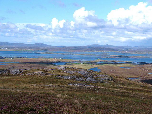 Photo could not load
NF8253 : North from Ruabhal
Gordon Hatton
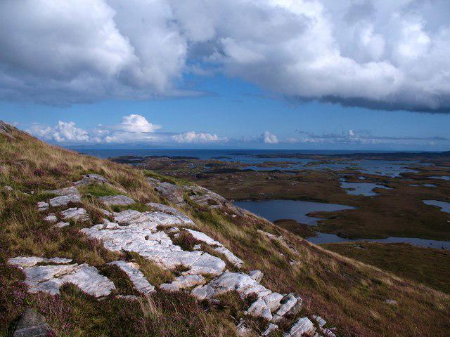 Photo could not load
NF8253 : On the slopes of Ruabhal
Gordon Hatton
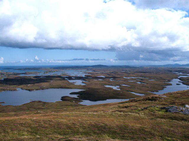 Photo could not load
NF8253 : Water, bog and sky
Gordon Hatton
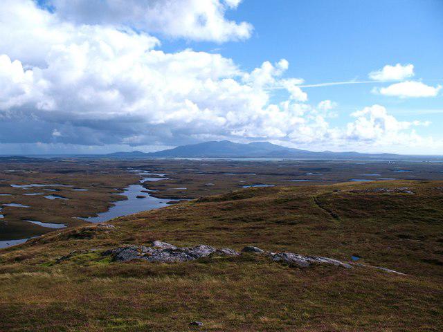 Photo could not load
NF8253 : View from Ruabhal summit
Gordon Hatton
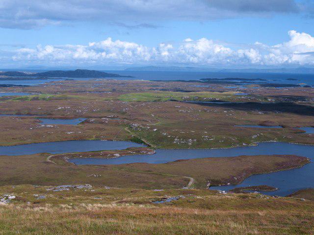 Photo could not load
NF8253 : East from Ruabhal summit
Gordon Hatton
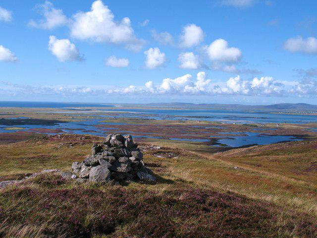 Photo could not load
NF8253 : Cairn on Ruabhal
Gordon Hatton
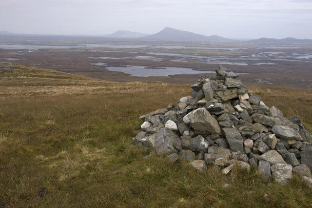 Photo could not load
NF8253 : Cairn on summit of Ruabhal
Tom Richardson
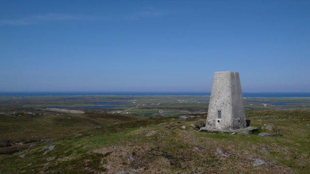 Photo could not load
NF8253 : Ruabhal trig point
Calum McRoberts
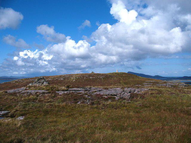 Photo could not load
NF8253 : Approaching the summit of Ruabhal
Gordon Hatton
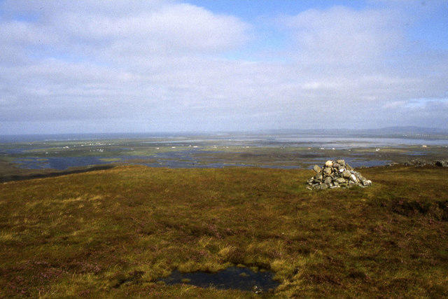
NF8253 : Summit of Ruabhal, Benbecula
Colin Park
Hill facts and local notes
Classifications
Elevation
124m
407 ft
Prominence
124m
Coordinates
57.4591, -7.2961
NF825533
OS Map
22
Explorer: 453N
At the Summit
The summit features a large, distinctive cairn offering a great spot to bask in glory after a rewarding climb. It also provides ample space for a picnic and a well-deserved breather.
Terrain & Geology
Ruabhal is primarily composed of Lewisian gneiss, one of the oldest rock types in the world, formed over 3 billion years ago. This gives the mountain its rugged and ancient appearance, and it's practically a geological 'grandfather' in the world of mountains.
Views & Scenery
From the summit, you can see the stunning panoramas of the sea lochs, the distant mountains of Harris, and the rolling landscape of Lewis. On a clear day, the vistas are simply breathtaking.
History & Heritage
Name Origin
The name 'Ruabhal' derives from the Gaelic term 'Ruadh Bhal', meaning 'Red Hill', likely referring to the reddish hue of the gneiss rock in certain lights.
Historical Significance
Ruabhal has been an important landmark for locals and sailors for many years, serving as a point of navigation as well as part of the rich cultural landscape of the Outer Hebrides.
Getting There & Facilities
Check current local access restrictions, parking rules and transport timetables before travelling. These notes do not confirm public access to the summit.
Parking
There is ample parking available at the starting point in Stornoway. Follow signs for public car parks near the waterfront.
Public Transport
Regular bus services operate from Stornoway, which is the main hub for public transport in Lewis. Look for buses heading towards Scalpay, with stops en route.
Nearby Facilities
Stornoway offers an array of facilities, including cafes, restaurants, and public toilets. Grab a local pie before you hit the trails - it’s a vital source of hiking energy!
Safety Information
Known Hazards
- As with any hike, watch out for sudden changes in weather, strong winds, and slippery rocks, especially after rain. The ground can also be quite boggy in places, so keep an eye on your footing.
General Safety Tips
- Check weather conditions before setting out
- Carry appropriate clothing and equipment
- Let someone know your planned route
- Take a map, compass, and GPS device
- Carry emergency supplies: food, water, first aid kit, torch
Hills
Some common questions about the hills answered
Are there group walks up Ruabhal [Rueval]?
Many walkers use Walkmates to join or organise walks with others. You can check for group walks around Ruabhal [Rueval] through the maps
Are there other walkers around Ruabhal [Rueval]?
Activity varies by location and time, but Walkmates lets you see whether others have shared walks or shown interest in this area. Find other people through the walking friends search walking friends for Ruabhal [Rueval] search or of course create your own walk for Ruabhal [Rueval]
Can I organise a walk to Ruabhal [Rueval]?
Yes. If there aren’t any walks listed already, you can create a walk and make it available for others to join.
If you're signed up to Walkmates, you can create a walk to Ruabhal [Rueval].
How do I find a walk up this hill?
There are often multiple ways to walk this hill, depending on experience and route preference. Walkmates helps you explore walks and routes that others have shared.
Can I suggest a new route up Ruabhal [Rueval]?
Yes. You can suggest or create routes to share with others. Walkmates focuses on the social side of walking, so routes are used to help people organise walks and explore areas together, rather than as detailed navigation tools or route libraries.
Other uses really appreciate knowledgeable walkers sharing their routes. Share your favourite route to Ruabhal [Rueval] here
The is an error or something incorrect about this hill. How do I let you know?
We always strive to keep the information on Walkmates as accurate as possible. If you find an error, please let us know through the contact form and we'll aim to correct it as quickly as possible
Community Discussion
Comments
Location
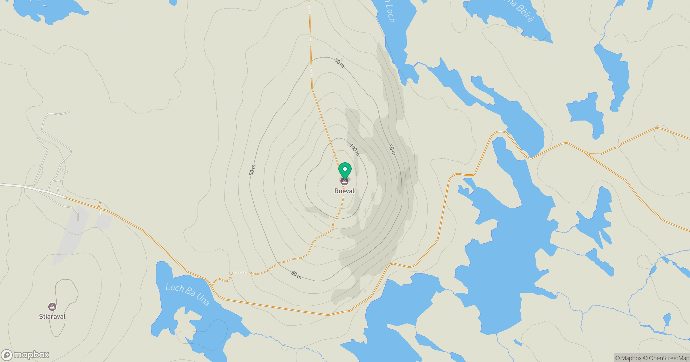
Grid reference: NF825533
View on OpenStreetMapOpens a map in a new tab, centred on the hill.
Hills within 30 km
Straight-line distance, not a walking route or confirmation of access.
No comments yet. Be the first.